Showing posts with label Maps. Show all posts

Tuesday, October 22, 2013

Unto the Sea Shall Thou Return: Boston, 2050

Chris Beneke

On my office wall, I have a replica 1775 Boston map. It looks like this:

Zoom view
Boston, 1775
As I stared idly at it last week, I was suddenly struck by how much the drawing resembled other maps that I'd seen recently, such as this one:

These Scary Maps Explain What Sea Level Rise Will Mean in Boston
Projected map of Boston after a 5 ft. seal level rise (coupled with another 2.5 ft. storm surge.)
If you concentrate only on the grey areas above, you should discern (as I finally did) an eerie resemblance to the 1775 map at the top.

I wasn't the first to notice the similarity. The Atlantic ran a piece last February that I missed, and perhaps you did as well. There, Emily Badger noted the resemblance between Boston in the 1640s and the exceedingly damp, post-global warming projections of what it will look like in 2050, 2100, etc.

By dint of massive and repeated landfills over the last two centuries, Bostonians have doggedly claimed areas that once belonged to the sea. Before this century is over, the sea may be taking many of them back.

Friday, June 7, 2013

Maps and History Roundup


Stephanie Butnick, "Maps Chart Speech Patterns Across America," Tablet Magazine, June 5, 2013

Today in fun charts: Joshua Katz, a statistics PhD student at N.C. State University put together a series of maps of the United States which reveal the staggering extent to which where we live in influences how we say what we say. Basically, why New Yaw-kers speak differently than, say, Texans. In addition to illustrating the geographic coordinates of the sub/hoagie and soda/pop debates, Katz’s cartographical endeavor plots contentious pronunciation from coast to coast: caramel (where more vowels get dropped the further west you go), crayon (all over the board, literally), and mayonnaise (which I prefer to simply avoid both in speech and practice).>>>

Mickey Mellen, "Historic Overlay Maps of North Carolina," Google Earth Blog, June 3, 2013

Image overlays have consistently been one of the neatest features in Google Earth.  The most common use of overlays is to show imagery that is more fresh than what can be found in Google Earth (such as this one from President Obama’s Inauguration or this one from the oil spill in the Gulf of Mexico).  However, overlays can also be used to showcase alternate maps such as detailed topography or historical maps like we’ll show you today.>>>

Monday, April 15, 2013

Globalizing the Nineteenth Century

Joseph L. Yannielli

This is cross-posted from the blog Digital Histories at Yale.

Nineteenth-century Americans viewed themselves through an international lens. Among the most important artifacts of this global consciousness is William Channing Woodbridge’s “Moral and Political Chart of the Inhabited World.” First published in 1821 and reproduced in various shapes and sizes in the decades prior to the Civil War, Woodbridge’s chart was a central and popular component of classroom instruction. I use it in my research and teaching. It forms a key part of my argument about the abolitionist encounter with Africa. And every time I look at it, I see something new or unexpected.
Chart of the Inhabited World:
Exhibiting the Prevailing
Religion, Form Of Government, 1821

Like basketball and jazz, the moral chart is an innovation unique to the United States. The earliest iterations depart from the Eurocentric and Atlantic focus with which modern readers are most familiar. Reflecting the early American obsession with westward expansion, they gaze out over the Pacific Ocean to East Asia and the Polynesian Islands. The chart features a plethora of statistical and critical data. Nations and territories are ranked according to their “Degrees of Civilisation,” form of government, and religion. Darker colored regions are “savage” or “barbarous” while rays of bright light pour out from the Eastern United States and Northern Europe.

Friday, March 1, 2013

Mapping the Past Roundup


Maureen McGavin, "Digital project focuses on Lincoln-based sermons," Emory News Center, February 22, 2013
The route of Lincoln's funeral train

A group of graduate students at Emory University specializing in digital research in the humanities have created a new website that uses digital tools to analyze and compare the text of sermons delivered after Abraham Lincoln's assassination.

Their project uses various digital text tools to map geographic and thematic patterns in the collection of 57 sermons, which reside in the Manuscript, Archives and Rare Book Library of Emory's Robert W. Woodruff Library. The scholars are calling their project "Lincoln Logarithms: Finding Meaning in Sermons" and they hope it will become a model for the next wave of research in the humanities.
>>>

Max Fisher, "A surprising map of the world’s national holidays (only two countries have no national day)," Washington Post, February 26, 2013

This map, inspired by a Reddit thread with a similar map, shows the national days of the world’s countries. As you can see, the world is mostly divided between countries that celebrate a national independence day and countries that celebrate a national unification or revolution day. The outliers are a tiny minority, and only two countries have no formal national day at all.
>>>

Thursday, January 3, 2013

History through the Eyes of . . . Pytheas the Greek

Randall Stephens

I've been reading Peter Ackroyd's wonderful Foundation: The History of England, Volume 1 (Pan, 2012). In typical fashion, Ackroyd's prose sparkles and he ranges effortlessly from the misty realms of prehistory to the demise of the first Tudor monarch, Henry VII, in 1509.  Fascinating anecdotes, panoramic descriptions of geography, and the voices of the dead make the book come alive.  One character in particular in the early pages piqued my interest. 

He was one of the earliest travelers to describe the landscape and customs of the British Isles. Greek geographer and explorer Pytheas made his voyage to northern Europe in roughly 325 BC.  Pytheas's chief work, On the Ocean, is lost somewhere in the dustbin of history.  But, we know of his discoveries through the Greek historian Polybius and the Greek geographer Strabo, as well as Pliny the Elder in later years.  And he was cited by around 18 others as well.

Here is Strabo on suspicions surrounding the Greek wanderer: "Pytheas asserts that he explored in person the whole northern region of Europe as far as the ends of the world—an assertion which no man would believe, not even if Hermes made it." Zing. The ancients used him as a model of untrustworthiness.  He was, in their words, a liar.

Friday, December 14, 2012

Historic Maps and Digital Mapping Roundup

.
Historic Maps and Digital Mapping Roundup
"Was your street bombed during the Blitz?" Telegraph, December 6, 2012

The year-long mapping project, devised by geographer Dr Kate Jones of the University of Portsmouth, uses red bomb symbols to illustrate where each bomb landed.>>>

Neal Conan, "'A History Of The World' Through A Mapmaker's Eyes," WWNO npr, November 26, 2012

World maps help us make sense of the world around us, and our place in it.

While mapmakers may portray their world maps as accurate, scientific and neutral, every single one describes the world from a certain worldview and culture. From ancient Babylonia to the Renaissance, cartographers have been driven by politics, religion, emotion and math.
>>>

Edel Howlin, "World Wants A Little Piece Of Texas On A Map," KUHF npr, November 29, 2012

The Texas General Land Office has been selling map reprints since 2002 with sales numbers jumping around November and December. James Harkins is with the Land Office and says many of their holiday orders come from customers across the pond.


“And that’s because during the 19th century there was a mass immigration movement into Texas from Europe and there are dozens of maps of Texas that were written in German that talked about what a great place Texas is. That the hills in the hill country remind Germans of what it’s like back in Germany.”
>>>

Bill Bowden, "Researchers pinpoint historic Prairie Grove sites," Atlanta Journal Constitution, December 9, 2012

The locations were found using a combination of old and new technologies — everything from ground-penetrating radar to shovel tests. Historical descriptions, a map drawn by a Union soldier and aerial photographs from 1941 also provided valuable information.>>>

Wednesday, December 5, 2012

The Kansas Gold Rush

Dan Allosso

Map of Kansas and Nebraska Territories, 1854
Kansas! For most East and West-coasters, it’s one of those flyover states.  Even for Midwesterners like me, it’s most frequently remembered as a long flat stretch of driving, on the way to someplace else.  With apologies to Kansans, for many other Americans Kansas is either a band from the 70s (“Point of Know Return,” remember? “Dust in the Wind”?), the gray place Dorothy lived before being swept into Technicolor Oz, or the scene of an early, bloody civil war that helped push the nation over the brink between the 1854 Kansas-Nebraska Act and statehood in 1861.

So I was surprised today, when I discovered in a January, 1859 Ranney Letter that “more than two hundred persons in this county” in southern Michigan were planning to go to Kansas in search of gold the following summer.  It hadn’t occurred to me–maybe because I’m familiar with the flat, drive-through Kansas you can see on current maps–that the Nebraska and Kansas Territories extended to the Rocky Mountains and contained quite a bit of what is now Colorado and Wyoming, as well as a big section of the northern foothills (including the Black Hills) that in 1861 would become the Dakota Territory.

Friday, August 31, 2012

History Book Reviews Roundup

.
"Views of the world: There is no such thing as an objective map," Economist, September 1, 2012

AROUND 150 AD an astronomer named Claudius Ptolemy wrote a book about how to make a proper map of the world. Penned in Greek on a papyrus scroll, the work, known as the “Geography”, is one of the most famous ancient texts on the science of mapmaking. It placed the job firmly in the domain of the geographer, who could use astronomy and mathematics to calculate from the stars what the world looked like below.>>>

Richard J. Evans, "Merchant, Soldier, Sage: A New History of Power by David Priestland – review," Guardian, August 23, 2012

In this concise but extremely ambitious book, the Oxford historian David Priestland sets himself the task of taking the long view of the financial crisis that afflicts the world today. His argument is that the year 2008, when the credit crunch began, is as important as 1917, the year of the Bolshevik revolution in Russia, or 1945, when the second world war came to an end. Four years on, the crisis shows no sign of coming to an end, and political systems, economies and societies seem in a state of disarray – even looming collapse.>>>

Dan Olson, "Historical accounts of U.S.-Dakota War change through years," Minnesota Public Radio, August 17, 2012
 
ST. PAUL, Minn. — Historians agree that the U. S. - Dakota War of 1862 was one of Minnesota's most momentous events.

The war's history has been documented and shared by people who have a range of perspective and accounts of it have changed over time.

Historian William Lass has reviewed 13 histories of the war, and he recommends reading, "The Dakota War of 1862," for several reasons.
>>>

Pat Padua, "Book Review: Atomic Comics: Cartoonists Confront the Nuclear World by Ferenc Morton Szasz," Seattle Post-Intelligencer, August 15, 2012

The year's biggest summer blockbuster, The Dark Night Rises, may be forever marred by a tragic footnote, but the fear that the movie itself plays on is time-honored and even old-fashioned: nuclear anxiety.

Pop culture has a long history of dealing with nuclear promise and danger, and the late historian Ferenc Morton Szasz argues in Atomic Comics: Cartoonists Confront the Nuclear World that the pluses and minuses of splitting the atom were most efficiently conveyed to the general populace in comic books.
>>>

Sameer Rahim, "From the Ruins of Empire by Pankaj Mishra: review," Telegraph, August 6, 2012

Reviewing Niall Ferguson’s Civilisation in the London Review of Books last year, the Indian writer Pankaj Mishra was fearsomely critical of the historian’s account of the West’s rise. Ferguson had identified the six “killer apps” that enabled European domination: property rights, competition, science, medicine, consumer society and the work ethic. Emphasising these qualities, Mishra pointed out, underplayed the role of slavery, colonialism and indentured labour in the West’s triumph. Seen in this light, Ferguson’s “killer apps” looked less benign.
>>>

Friday, November 18, 2011

Historical Maps Roundup

.
Amy Standen, "New Water Map Washes Away An Urban Legend," KQED, October 29

A new, revised map of San Francisco has hit the stands. It's not a street map or a bus map; it's a map of the city's underground waterways, and it includes a change to what could be San Francisco's oldest urban legend. The map is the work of creek geologists Janet Sowers and Christopher Richard. They're like water detectives; they hunt for clues of old creeks and marshes that once ran through San Francisco. One mystery has nagged Richard for years.>>>

"UW librarians create digital historical street map," November 15, 2011

WATERLOO REGION — If you squint just right, you can almost imagine what Dearborn Street would have looked like before the University of Waterloo, before the plazas came and the condos appeared.>>>

Agustin Armendariz, "Historic California Maps: The U.S. Geological Survey Adds Over 13,000 Historical Topographic Maps To Its Archive," Huffington Post, November 10, 2011

This week, the U.S. Geological Survey added 13,688 historical California topographic maps to its online archive, hundreds of which date back to the 1800s. From the Gold Rush town of Downieville in the Sierras to El Cajon in the hills above San Diego Bay, the maps provide a picture of California from before the 20th century through the past decade.>>>

Benjamin Sutton, "Historical Map Reveals Location of Brooklyn's Native American Burial Ground," L Magazine, November 2, 2011

The Brooklyn Historical Society has lots of cool old maps, the latest of which it posted yesterday. It's Brooklyn Borough Historian (1944-71) James A. Kelly's 1946 "Indian villages, paths, ponds, and places in Kings County" map, and in addition to known Native American settlements in the borough and the routes connecting them, it also situates a major burial ground smack in the middle of brownstone Brooklyn.>>>

Wednesday, October 12, 2011

Where the Newspapers Were

Randall Stephens

My friend Leslie Graham just sent me a link to a wonderful map resource: "Data Visualization: Journalism's Voyage West." Part of Stanford University's Rural West Initiative, the site tracks the spread of newspapers into the American interior and the West. "With the American newspaper under stress from changing economics, technology and consumer behavior," notes the introduction, "it's easy to forget how ubiquitous and important they are in society. For this data visualization, we have taken the directory of US newspaper titles compiled by the Library of Congress' Chronicling America project--nearly 140,000 publications in all--and plotted them over time and space."

Friday, October 7, 2011

Historical Maps Roundup

.
Darren Murph, "'What Was There' project adds a pinch of history to augmented reality," engadget, September 18, 2011

So, it works as such. You dig up ancient photos -- a few generations prior, or even a few decades ago -- scan 'em in, and tag them to their rightful place on Google Maps. Then, folks who visit the 'What Was Here' project website or download the iOS app (all linked below) will be able to see what kind of world they'd be living in if Uncle Rico's time machine actually worked.>>>

“Toward a National Cartography: American Mapmaking, 1782-1800,” Artfix Daily, October 6, 2011

SOUTHAMPTON, MA – Boston Rare Maps, one of the country’s premier specialist dealers in rare and unusual antique maps, presents AmericanMapmaking.com, a virtual online exhibition of antique American maps from the late 18th Century. Originally hosted at the Harvard Map Collection, Toward a National Cartography: American Mapmaking, 1782-1800 traces the evolution of mapmaking during the formative years after the American Revolution, revealing the ways in which Americans sought to transform the landscape to suit their newly established economic and political goals. Included in the exhibition are works by renowned mapmakers such as Osgood Carleton, Andrew Ellicott, John Fitch and many others. For additional information or to view the virtual exhibition online, please visit www.AmericanMapmaking.com.>>>

"Hawaii mapping exhibit set," Maui News, September 14, 2011

WAILUKU - "The Mapping of Hawaii," an exhibit that traces the history of the Hawaiian Islands through maps, will be on display at the Bailey House Museum from Oct. 1 to 15.

There also are two other events tied to the traveling exhibit - on Oct. 7 at First Friday Wailuku, where the exhibit will be open for free, and Oct. 8 with speaker Riley Moffat, an authority on Hawaiian maps, speaking on the mapping of Maui from 1778 to 1929 at the Bailey House.>>>

"Travel website offers a whole new way to discover history,"
Jerusalem Post, October 2, 2011

From history fans to vacation sightseers, it seems that we all flock to see historic sites on our travels. Yet, while many of us follow the traditional tourist trail, one website is offering a simpler way to discover more of the world’s historic wonders, whether they be national landmarks or hidden gems.

Historvius.com maps the world’s top historic sites online, making it simple and easier for people to gather information and ‘visit’ great historic places across the globe.>>>

"In pictures: Scotland on the map," BBC, September 22, 2011

A new book, Scotland: Mapping the Nation, brings together historic and unusual maps as a "window into Scottish history". The Ptolemy map is the earliest known depiction of Scotland in a map. Ptolemy was a 2nd Century Roman geographer. This map first appeared in a book in 1654. The maps come from the National Library of Scotland.>>>

Thursday, May 5, 2011

Ancient History & Archeology Roundup

.
"The Inca Empire," National Geographic (May 2011)

See the extent of the Inca Empire in this interactive map.>>>

Melik Kaylan, "Rare Objects, Rarer Practices," Wall Street Journal, May 5, 2011

Great archaeological finds accrue history and tell fresh stories long after they're snugly ensconced in museums, not least because, as times change, the world asks new questions about ancient cultures and archaeology itself. Were the excavators heroes or looters? Did they, on balance, preserve or harm the site? Do we now approve of the site's original inhabitants—how did they treat their women or minorities? Can we garner any tips on how we might live today? The splendidly informative "Dura-Europos" show at the Boston College McMullen Museum touches on many such matters with dexterity—but it also lets us enjoy the old-fashioned delights of peering across the millennia in wonder.>>>

Megan Gambino, "What Secrets Do Ancient Medical Texts Hold?" Smithsonian (May 2011)

In 2002, Alain Touwaide came across an article about the discovery, some years before, of a medical kit salvaged from a 2,000-year-old shipwreck off the coast of Tuscany. Divers had brought up a copper bleeding cup, a surgical hook, a mortar, vials and tin containers. Miraculously, inside one of the tins, still dry and intact, were several tablets, gray-green in color and about the size of a quarter.

Touwaide, a science historian in the botany department at the National Museum of Natural History, recognized that the tablets were the only known samples of medicine preserved since antiquity. “I was going to do everything I could to get them,” he says.>>>

Peter Thonemann, "The Messiah codex decoded," TLS, April 6, 2011

"Are Lead Tablets Discovered in a Remote Cave in Jordan the Secret Writings About the Last Years of Jesus?” the Daily Mail wondered. “A group of 70 or so ‘books’, each with between five and 15 lead leaves bound by lead rings, was apparently discovered in a remote arid valley in northern Jordan somewhere between 2005 and 2007 . . . . They could, just possibly, change our understanding of how Jesus was crucified and resurrected, and how Christianity was born”: thus the BBC’s religious affairs correspondent. “Containing cryptic messages in Hebrew and Ancient Greek, the codices were etched in an indecipherable code”, added the Daily Telegraph. “Academics speculate that they are actually the lost collection of codices mentioned in the Bible’s Book Of Revelation . . . [they] appear to refer to the Messiah and possibly even to the Crucifixion and Resurrection”: the Mail again.>>>

"The 'Clash' At Marathon Shaped Greece, And The West," NPR, April 25, 2011

At the start of the fifth century B.C., the Persian empire was the world's paramount power, stretching from the Mediterranean Sea to North Africa to the Indian subcontinent. But the Persian emperor, King Darius, did not control Athens — and defeating its much smaller army seemed a relatively small matter.

In September of 490 B.C., Persian troops advanced on 10,000 vastly outnumbered Greek soldiers on the Plain of Marathon. But the Greeks managed to crush the Persian army that day and, as the story goes, ran all the way home to preserve their victory.>>>

Sunday, August 22, 2010

The Past Mapped Out

Randall Stephens

As Geography without History seemeth a carkasse without motion; so History without Geography wandreth as a Vagrant without: a certaine habitation.

- Captain John Smith

Geography was many things without a doubt, but for the young Frenchmen shut in classrooms, in ugly and sullen study rooms (the bottom painted chestnut, the top in dirty ochre, and above the bent heads, the pale and stifling light of gas) . . . geography was fresh air, a stroll in the countryside. the journey back with an armful of broom and foxglove, eyes cleaned out, brains washed, and the taste of the "real" biting the "abstract."

- Lucien Febvre

As the semester revs up, quite a few history profs are looking on-line for primary source docs, web-based activities, digital images, and on-line map collections. I use a healthy does of maps and map progressions in the various courses I teach. I've also just started giving more map quizzes. As an undergrad, I always felt I gained a great deal from historical geography. Not sure if that's the same experience as my students. Yet, quite a few seem to appreciate the historic context of changing boundaries, the view of how landscape shapes culture, the movement of peoples, demographics, and the like. Here are some of the sources I turn to:

History Maps for the Classroom:

Map Central (Bedford/St. Martin's). World, western, and American maps.

American: A Narrative History (W. W. Norton). Map and image resources for American history.

Western Civilizations, 16th Edition (W. W. Norton). Features Map Player, a slide show with audio.

The Earth and Its Peoples: A Global History, Third Edition (Houghton Mifflin)

Stanford University Library, list of African Maps

Antique Maps:


Also of Interest:

Wednesday, March 24, 2010

Roundup: Maps through Time

Randall Stephens

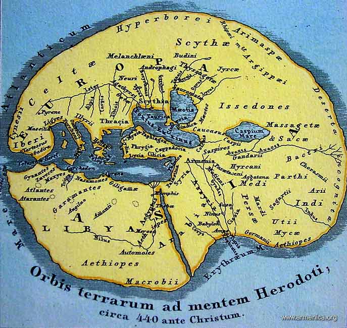
What better way to learn about the past, and what people once made of the world around them, than to study maps? A few days ago I read a fascinating passage in Herodotus: "If, therefore, I judge correctly of these things, the Ionians are mistaken with respect to Egypt; but if their opinion is correct, then I will show that neither the Greeks nor the Ionians themselves know how to reckon, when they say that the whole earth consists of three divisions, Europe, Asia, and Libya; for they ought to add a fourth, the Delta of Egypt, if it be not a part either of Asia or of Libya." A wonderful picture of the world.

I post here some wonderful recent on-line articles dealing with history, cartography, and cultural context. (One piece in particular got me thinking about an iPhone app I'd like to see. How about an interactive historical, walking map of 18th-century Boston? Strolling around the city, the iPhone-toting flaneur would notice that he would be under water were he at this or that place in 1770.)

Michael Church, "The Truth about Maps: How Cartographers Distort Reality," The Independent, March 20, 2010.

As a fascinating new exhibition shows, it's not always what they put in that matters – but what they leave out

What is a map? In effect, says Peter Barber, head of maps at the British Library, a map is a lie. "Unless you have a scale of one-to-one, every map is subjective, and always will be," he explains. "You have to select what you put on it." And selection involves rejection.

Throughout history, such lies have generally served purposes which have been political, religious or philosophical rather than scientific. >>>

Shirley Dent, "Literary London on your iPhone," Guardian Books Blog, March 23, 2010

A new iPhone application which brings the capital's literary heritage to life has made me a hazard on the streets of London. >>>

Cora Lewis,"Maps and Manuscripts Illustrate an Old Worldview," Yale Daily News, March 23, 2010

Napoleon Bonaparte famously had his men re-draw the world’s map to make France larger, but he wasn’t the only historic figure who tried to alter the public’s perceptions with cartography.

“Invented Bodies: Shapely Constructs of the Early Modern,” now on view at the Whitney Humanities Center, features maps and manuscripts from the 15th through 18th centuries, depicting Europeans’ interpretations of their world — from realistic renderings to fantastical imaginings. >>>

Steven Heller, "The World as Their Canvas," New York Times, March 5, 2010

There’s nothing like sitting by the fire with a good book, except maybe sitting by the fire with a good map—or better yet, a good book about maps. I’ve noticed an upsurge in cartographic interest these days, especially for maps’ value as conceptual artwork. >>>

Michael Elliott, "A World Map Under Eastern Eyes," Time, February 25, 2010

What does China really think of the U.S.? Spend some time in the Middle Kingdom, and you'll hear both protestations of admiration and plenty of disparaging comments about the West. Such attitudes have a long history. In 1602 the imperial Chinese court learned that the inhabitants of North America were "kindly and hospitable to strangers." >>>